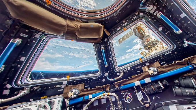
This week Google released its latest remarkable Google Street View Project. Thanks to ESA astronaut Thomas Pesquet who has been on-board the International Space Station (ISS) from 17th of November 2016 until 2nd of June 2017, Google captured Street View imagery and thereby mapped the whole space station with all its 15 modules in 360 degree. Because of the particular constraints of living and working in space, it wasn’t possible to collect Street View using Google’s usual methods. Instead, the Street View team partnered with The Center for Advancement of Science in Space (CASIS) and The National Lab to develop a mapping strategy during a two days workshop in NASA’s scale model. They were only using the equipment on-board and used the bungee coords to stabilze the camera. Using this method, Thomas Pesquet collected still photos in space, that were sent down to Earth where they were stitched together by the Google team to create panoramic imagery of the ISS.
The virtual insights and views to the earth, are not only fascinating, but also crystal clear and sharp, like normal Street View captures. There was a lot of troubleshooting and planning involved, before collecting the final imagery that you can see today in Street View (see the video for the story behind the scences).
As you can see during the “flight” through the ISS, it has technical equipment on all surfaces, with lots of cables and a complicated layout with modules shooting off in all directions—left, right, up, down. And it’s a busy place, with six crew members carrying out research and maintenance activities 12 hours a day. There are a lot of obstacles up there, and additionally Thomas Pesquet had only limited time to capture the imagery.

